


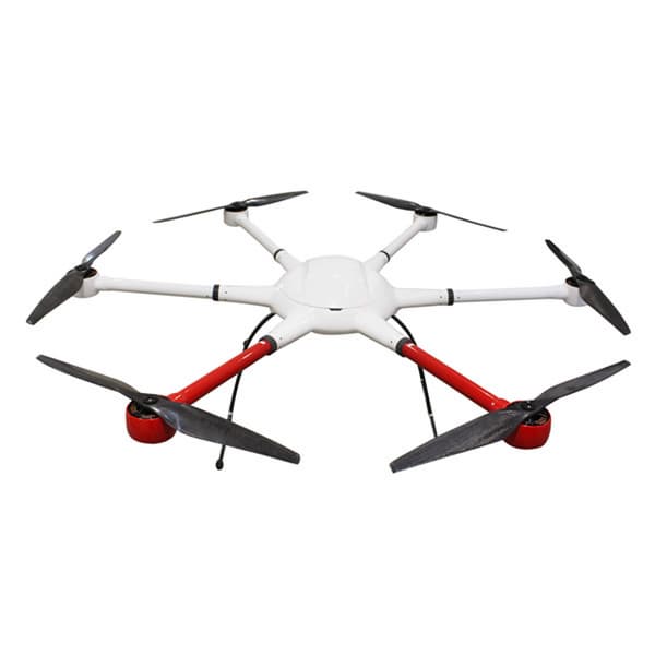

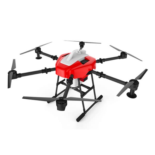
Aerial UAV—Control Survey
Negotiable Min Order Quantity Unit
- Required Quantity
-
- Place of Origin
- China
- Brand name
- TTF
- Payment Terms
- Negotiable
- Production method
- Negotiable
- Shipping / Lead Time
- Negotiable / Negotiable
- Keyword
- fpv drone, racing drone
- Category
- Other Consumer Electronics
Apply a video call to the Supplier
Shenzhen TitanFlying Technology Co., Ltd
 China
China
- Verified Certificate
-
6

| Product name | Aerial UAV—Control Survey | Certification | - |
|---|---|---|---|
| Category | Other Consumer Electronics | Ingredients | - |
| Keyword | fpv drone , racing drone | Unit Size | - |
| Brand name | TTF | Unit Weigh | - |
| origin | China | Stock | - |
| Supply type | - | HS code | - |
Product Information
B2B Trade
| Price (FOB) | Negotiable | transportation | - |
|---|---|---|---|
| MOQ | Negotiable | Leadtime | Negotiable |
| Payment Options | Negotiable | Shipping time | Negotiable |
- President
- Hisen
- Address
- NO.15 Chaoyang road, Yanluo street, Songgang town, Baoan District, Shenzhen
- Product Category
- Electrical Equipment,Other Consumer Electronics
- Year Established
- 2015
- No. of Total Employees
- 501-1000
- Company introduction
-
Established in 2005, Shenzhen TitanFlying Technology Co., Ltd (TTF) is located in Shenzhen Univercity Town, known as the silicon vally of China.TTF Technology is a high-tech enterprise and professional Aero-Model manufaturer that unifies product design, research&development, production, marketing and customer service. Our main product is the UAV Power System, Gimbal System and PTZ Control System.We have a whole machining industry chain. All our products, from the materials processing to completed products, were manufacturered by ourselves. Thus the quality and the consistency can be well controlled and always be the top of the industry. Besides the standard edition, we also supply customer-exclusive edition, which has its own SN for each product. (Support all your requests)""Touch The Future"" is the company slogon of TTF Technology, and we know that we cannot achieve this goal without your support and attention. So we will continuously provide you our best-quality products with super material and unique technology.
- Main Markets
-
 Belarus
 Botswana
 Burkina Faso
 Cape Verde
 Croatia
 Egypt
Egypt
 Iran
Iran
 Kuwait
- Main Product


Related Products

REPELLO ( Electronic Mosquito Reppeller )

Interactive Flat Panel Display (UHD)

Auto Wet Towel Dispenser SOT-2001H (Made in Korea)

Cafe Specialty A1_SELF-SERVE HOT & ICED CAFE MACHINE with various cashless payment system

VENUSTA XO9_COMPACT OCS ESPRESSO COFFEE MACHINE
